|
| string | Alias [get, set] |
| | Gets or sets the alias for the field. For use in application only, not used by MapWinGIS internally. More...
|
| |
| string | Expression [get, set] |
| | Gets or sets the expression for the field. For use in application only, not used by MapWinGIS internally. More...
|
| |
| ICallback | GlobalCallback [get, set] |
| | The global callback is the interface used by MapWinGIS to pass progress and error events to interested applications. More...
|
| |
| bool | Joined [get] |
| | Gets a value indicating whether this field is joined. More...
|
| |
| string | Key [get, set] |
| | The key may be used by the programmer to store any string data associated with the object. More...
|
| |
| int | LastErrorCode [get] |
| | Retrieves the last error generated in the object. More...
|
| |
| bool | Modified [get, set] |
| | Gets or sets a value indicating whether this field is modified. It is used during saving of changes for OgrLayer. The flag should be set by application code. More...
|
| |
| string | Name [get, set] |
| | Gets or sets the name of the field. More...
|
| |
| int | Precision [get, set] |
| | Gets or sets the precision of the field. Precision only applies to fields of fieldtype double. More...
|
| |
| FieldType | Type [get, set] |
| | Gets or sets the field type of the field. More...
|
| |
| bool | Visible [get, set] |
| | Gets or sets a value indicating whether the field is visible. For use in application only, not used by MapWinGIS internally. More...
|
| |
| int | Width [get, set] |
| | Gets or sets the width of the field. More...
|
| |
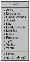
Represents a single field of the attribute table.
Graph description
To show the properties of the field the following code can be used:
if (field != null)
{
string s = string.Format("Name = {0}; type = {1}; width = {2}; precision = {3}",
Debug.Print(s);
}
Represents a single field of the attribute table.
Definition: Field.cs:48
FieldType Type
Gets or sets the field type of the field.
Definition: Field.cs:143
string Name
Gets or sets the name of the field.
Definition: Field.cs:125
int Precision
Gets or sets the precision of the field. Precision only applies to fields of fieldtype double.
Definition: Field.cs:134
int Width
Gets or sets the width of the field.
Definition: Field.cs:152
Provides a functionality for accessing and editing ESRI shapefiles.
Definition: Shapefile.cs:72
Field get_Field(int fieldIndex)
Gets a specific field stored in the attribute table.
Definition: Shapefile.cs:611
- Examples
- IntersectionLength.cs, and MinimalDistance.cs.