

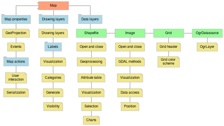
Here is an interactive diagram which provides access to the various functionality:
The documentation is generated from .NET interop assemblies rather then from the source itself, therefore C# syntax is used everywhere. However it doesn't mean that MapWinGIS usage is limited to the .NET languages only. See overview for more details.
The description of several large classes like AxMap or Shapefile is split into logical parts (modules). The complete list of API members with links is still present on the class page.