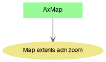
Here is list of properties and methods that affect map extents and zoom level. This module is a part of the documentation of AxMap class.
Graph description
◆ GetKnownExtents()
Gets known extents.
- Parameters
-
| extents | Known extents to retrieve. |
- Returns
- Extents object.
- New API 4.9.1:
- Added in version 4.9.1
◆ SetGeographicExtents()
| virtual bool AxMap.SetGeographicExtents |
( |
Extents |
pVal | ) |
|
|
virtual |
Sets geographic extents in decimal degrees for the map.
- Parameters
-
| pVal | Geographic extents in decimal degrees. |
- Returns
- True on success.
For operation to succeed, projection must be set for the map (see AxMap.GeoProjection property)
- New API 4.9.0:
- Added in version 4.9.0
◆ SetGeographicExtents2()
| bool AxMap.SetGeographicExtents2 |
( |
double |
xLongitude, |
|
|
double |
yLatitude, |
|
|
double |
widthKilometers |
|
) |
| |
Sets geographic extents for the map.
- Parameters
-
| xLongitude | Longitude of center of the screen (degrees). |
| yLatitude | Latitude of center of the screen (degrees). |
| widthKilometers | Width of displayed extents in kilometres. |
Projection for the must be specified in order for this method to work.
- Returns
- True on success.
- New API 4.9.1:
- Added in version 4.9.1
◆ SetLatitudeLongitude()
| void AxMap.SetLatitudeLongitude |
( |
double |
latitude, |
|
|
double |
longitude |
|
) |
| |
Sets the Latitude and Longitude of the center of the screen in one operation
- Parameters
-
| latitude | Requested Latitude in decimal degrees |
| longitude | Requested Longitude in decimal degrees |
Map projection must be set in order for this method to work.
- New API 5.1:
- Added in version 5.1.0
◆ CurrentScale
| double AxMap.CurrentScale |
|
getset |
Gets or sets the current map scale.
The scale depends on the AxMap.MapUnits property. Number of pixels per logical inch and the size of window are used to determine the size of the displaying device. The calculations represent the closest approximation as there is no way to determine the physical size of displaying device. The operation of setting the new scale preserve the map coordinates of the center point on the screen.
- New API 4.8:
- Added in version 4.8
- Examples
- EditAttributes.cs, RemoveShape.cs, SelectBox.cs, ToolTip.cs, Tracking.cs, and ZoomToValues.cs.
◆ CurrentZoom
Gets or sets the current zoom level for the map. It corresponds to the zoom level of current tile provider.
Map projection must be set in order for this property to work.
- New API 4.9.1:
- Added in version 4.9.1
◆ ExtentHistory
Gets or sets the number of extents to cache in the extents history
◆ ExtentPad
Gets or sets the percentage of the view used to pad the extents of a layer when zooming to a layer or maximum extents.
Padding makes it so that there is a small border around the layer when you zoom to it.
◆ Extents
◆ GeographicExtents
Gets geographic extents of the map in decimal degrees.
For operation to succeed, projection must be set for the map (see AxMap.GeoProjection property). Otherwise null will be returned.
- New API 4.9.0:
- Added in version 4.9.0
◆ KnownExtents
Gets or sets known extents for the map.
Map projection must be set in order for this property to work.
- New API 4.9.1:
- Added in version 4.9.1
◆ Latitude
Gets or sets latitude of the center of screen (in decimal degrees).
Map projection must be set in order for this property to work.
- New API 4.9.1:
- Added in version 4.9.1
◆ Longitude
Gets or sets longitude of the center of screen (in decimal degrees).
Map projection must be set in order for this property to work.
- New API 4.9.1:
- Added in version 4.9.1
◆ MaxExtents
Gets or sets the extents of the map displayed by the control.
- Examples
- Segmentation.cs.
